Medieval Landscape Development and Settlement History of the Sea Marshes in the Wangerland Region
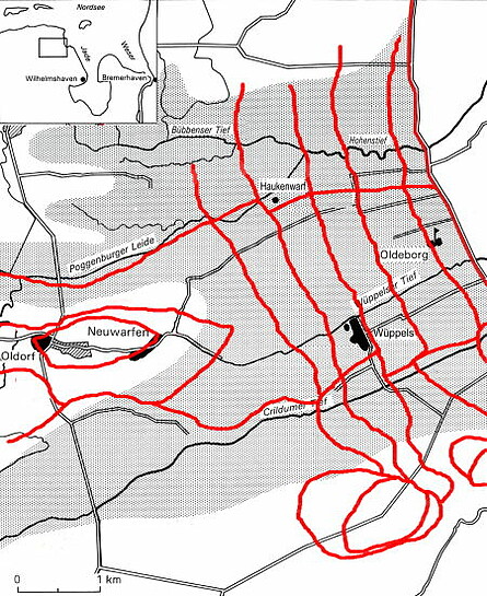
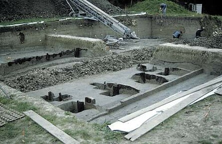
The Wangerland is located in the sea marshes to the north of Wilhelmshaven. During the Pre-Roman Iron Age this area was covered by the Crildum Bight which had silted up during the Middle Ages. Between 1990 and 1997, excavations on several Wurt mounds were carried out, within the scope of a project founded by the Gerd Möller-Stiftung, Wilhelmshaven, with the aim of studying how the area of the former bight was occupied in the course of the environmental changes and the inception of the construction of sea defences. The project was directed by Dr. J. Ey (focussing on the history of sea defences) and Dr. E. Strahl (focussing on settlement history). Through a study of historical maps, the interpretation of aerial photography, a field survey of sea wall remains as well as excavation and recording of sections in the sub-project “History of Sea Wall Defences” it was possible to gain many new insights into the alignment and construction of sea walls. This led to the discovery of circular dykes (Ringdeiche) at Oldorf and Neuwarfen. Enclosing the open field with banks of 1 m in height they represent the first phase of sea wall construction which was apparently erected in the 11th century. So-called “Sietwendungen”, probably built shortly after the circular dykes, channelled the water from the Geest (Pleistocene sandy soils) via the marsh deeps (ditches) through the dykes into the North Sea. These “Sietwendungen” terminated in section dykes which ran across the Crildum Bight. Several section dykes mark the individual phases of sea wall construction progressing eastward across the bight. They were the predecessors of the first winter sea wall running parallel with the coastline and which was probably erected during the 13th century. Like the section dykes the winter sea wall is no longer visible and can now only be traced through a seaward progression of areas with increasing marine sediment levels (“Poldertreppe”). Limiting the continued sedimentation by the North Sea of the land behind them, these distinct steps mark the lines of former sea walls, thus indicating chronologically and spatially separated phases of dyke construction.
Probably dating from the 14th century, the “Altendeich” is still easily discernible; it relates to a former winter sea wall running parallel with the coast along the road between Hooksiel and Horumersiel.
The investigations into the settlement history documented how this area was used for settlement as a consequence of sea wall construction from the 11th century onwards. Settlement started with the Wurt mound of Oldorf, which was raised by the first half of the 7th century on a spit of land still extending into the Crildum Bight. By the 9th/10th century the Wurt Neuwarfen was already located in the periphery of this spit. In the High- and Late medieval periods Wurt mounds like Wüppels or the Haukenwarf were integrated into the various lines of sea walls, thus highlighting individual phases of land reclamation.
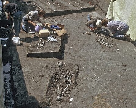
One of the few known burial sites in the sea marshes was partially uncovered at Oldorf. It is an inhumation cemetery of the early 9th century.
Bibliography
Ey, J., 2007: Early dike construction in the coastal area of Lower Saxony. In: J. Beenakker, F. Horsten, A. de Kraker u. H. Renes (Red.), Landschap in ruimte en tijd. Liber amicorum aangeboden aan prof. dr. Guus J. Borger [Festschrift zum 65. Geburtstag von G. Borger], 92-99 u. 230. Amsterdam.
Strahl, E., 2004: Mittelalter im Wangerland. In: M. Fansa, F. Both u. H. Haßmann (Hrsg.), Archäologie„ Land„ Niedersachsen. 25 Jahre Denkmalschutzgesetz – 400 000 Jahre Geschichte, 534-541. Archäologische Mitteilungen aus Nordwestdeutschland, Beiheft 42. Stuttgart.Strahl, E., 2006: Wangerland. In: J. Hoops (Begr.), Reallexikon der Germanischen Altertumskunde 33, 236-237. 2. Aufl. Berlin, New York 2006.


