Manifestation of power – fortification construction as evidence of social transformation processes in the coastal zone of Lower Saxony during the Middle Ages.

In a joint effort five scientific institutions and state agencies from northwestern Germany and the Netherlands investigate the development of late medieval fortifications, so-called ‘stone houses’, in the East Frisian peninsula between the rivers Ems and Weser. The research is primarily conducted by the NIhK (Thorsten Becker, Kirsten Hüser, Stefan Krabath, Michael Lunge). Further project partners are: 1. Ostfriesische Landschaft (Rolf Bärenfänger, Jan Kegler, Sonja König, Hajo van Lengen, Paul Weßels); 2. LGLN, State Agency for Geo-information and -survey of Lower Saxony, Department Aurich (Dipl.-Ing. Jens Keilmann); 3. State Archives of Lower Saxony, Aurich (Michael Hermann); 4. Fryske Akademy, Leeuwarden (Johannes Adriaan Mol). The project is sponsored by the state of Lower Saxony within the Pro*Niedersachsen program for a duration of three years.
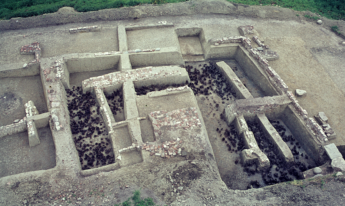
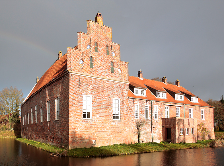
Frisia takes a place of special status in the larger region’s historical development: Whilst in medieval times most of Europe was reigned by feudal lords, the Frisian people organized themselves in autonomous rural municipalities. In time, however, local elites started to emerge from the wealthier farmers, raising fortified buildings to establish and secure their growing influence, eventually transforming the Frisian freedom into an aristocratic system in the 15th century. In order to investigate the processes of social transformation, the project focuses research on these fortifications, applying methods from archaeology and historical geography. Considering the archaeological record is of especially high relevance in dating the Frisian stone houses. Furthermore, the project aims to illuminate their function in context of territorial fortification, display of power and the protection of infrastructure. Likewise, their dependencies on land reclamation by dyke building are to be exemplified in the aftermath of historical flood events.
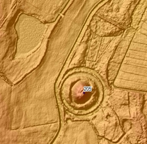
Preparatory research indicates the former existence of more than 500 sites of such fortification, laying the groundwork for the project’s analysis. In an innovative approach, high-resolution elevation models based on LIDAR-data are utilised to analyse the sites’ micro-topography for relicts of constructional features. This is complemented by archaeological and historical data from the state agencies’ archives, notably the material record and historical maps, as well as geophysical surveys conducted by the NIhK. Consequently, these findings are incorporated in a GIS-based spatial analysis to further our understanding of late medieval fortification and power structure in the context of East Frisia’s particular natural and cultural environment.
References
Bärenfänger, Rolf: Ostfriesische Verteidigung: Steinhäuser und Burgen. Mitteilungen der Deutschen Gesellschaft für Archäologie des Mittelalters und der Neuzeit 20, 2008, S. 69–76.
Hajo van Lengen, Geschichte des Emsigerlandes vom frühen 13. bis zum 15. Jahrhundert. 2 Bände. Abhandlungen und Vorträge zur Geschichte Ostfrieslands 53 (Aurich 1973–1976).