From the rampart into the marshlands
Following up field works and thus resulting findings from the previous years, further geoarchaeological and palaeotopographical investigations are planned for the area surrounding the early medieval Borgsumburg on the North Frisian island of Föhr.
In preparation for the excavation campaign this summer, inner part and near vicinity of the rampart will be prospected as well. Initial research questions and goals regarding the Borgsumburg as well as the surrounding landscape, natural waters and marshland development continue to provide the foundation for this years planned field works.
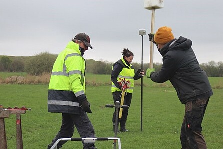
First prospection efforts took place this April, applying different geophysical and –archaeological methods (e.g. geomagnetism, susceptibility measurements, coring).
One focus of the prospection in April was the exploration of potential excavation sites for the upcoming summer campaign. Therefore, soil layers were documented at several locations within the fortress. Furthermore, a regular coring grid in the entrance area of the rampart revealed the course of a moat.
Coring surrounding the Borgsumburg served to investigate several topographic structures, which appear as shallow depressions visible in the height model. On historical maps, waters are depicted at these specific locations. Additionally, sediment samples were taken for geochemical, -physical and –botanical analysis. Selected layers of those samples shall also be dated by means of e.g. radiocarbon analysis.